Over time, Morro Rock was connected to the mainland, closing off the north entrance to the bay. There are many contradictory stories as to when this occurred. The photo essay below is an attempt to tell the true story in pictures as best we can. This document is intended primarily to support docent training and visitor education for a California State Park docent-led walk of the area.
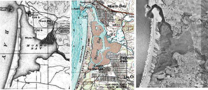
The above composite shows how Morro Bay (including the separation of Morro Rock from the mainland) has changed over the years. The left-most image is from an 1897 topographic map; the center image is from a 1981 topographic map; and the right-most image is from a 1994 satellite photograph. You will note that originally, Morro Rock was an island, and the sand spit to the south was fairly narrow and straight. After the north entrance of the bay was closed in the 1930-40's (see "progress" below), sea breaks built in the 1950's, and the harbor dredged, the sand spit took on its present form, drifting significantly to the east at its northern end. Note also the increase in the sedimentation in the bay. In 1897, the salt marsh leading out of Chorro creek formed an area much smaller than it is today. Within a couple of hundred years, the entire bay could be compromised by uncontrolled sedimentation. You can move your mouse over the above map top find "hot sport" which will take you to higher resolution images of the areas marked. (To download a "super-sized" version of the 1897 topographic map for printing, click here.)
Following is a series of photos in chronological order showing the area between Morro Rock and the mainland, from the late 1800's to present.
See our "Early Post Cards" area for many more old photos of the area.
Images below with a blue outline can be clicked to see an enlarged version.
04/2010 This link was removed at request of another site owner. |
|
| 04/2010 This link was removed at request of another site owner. Late 1800's |
|
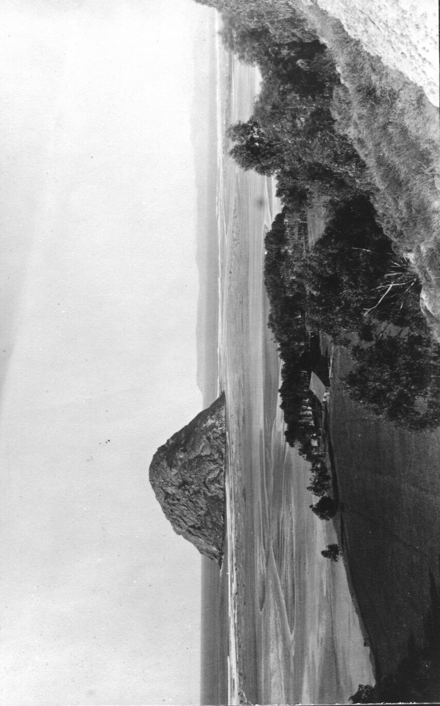
| (click thumbnail left to enlarge on screen) "Morro Bay Townsite" Card 9 #2a - Morro Rock, Source: Natural History Association SLOC Docent Library; "Morro Rock when it was still an island in the early 1900's" (Note: This Morro Rock #2a circa 1900 link supports full-page high-resolution printing) | |
| (click thumbnail left to enlarge on screen)
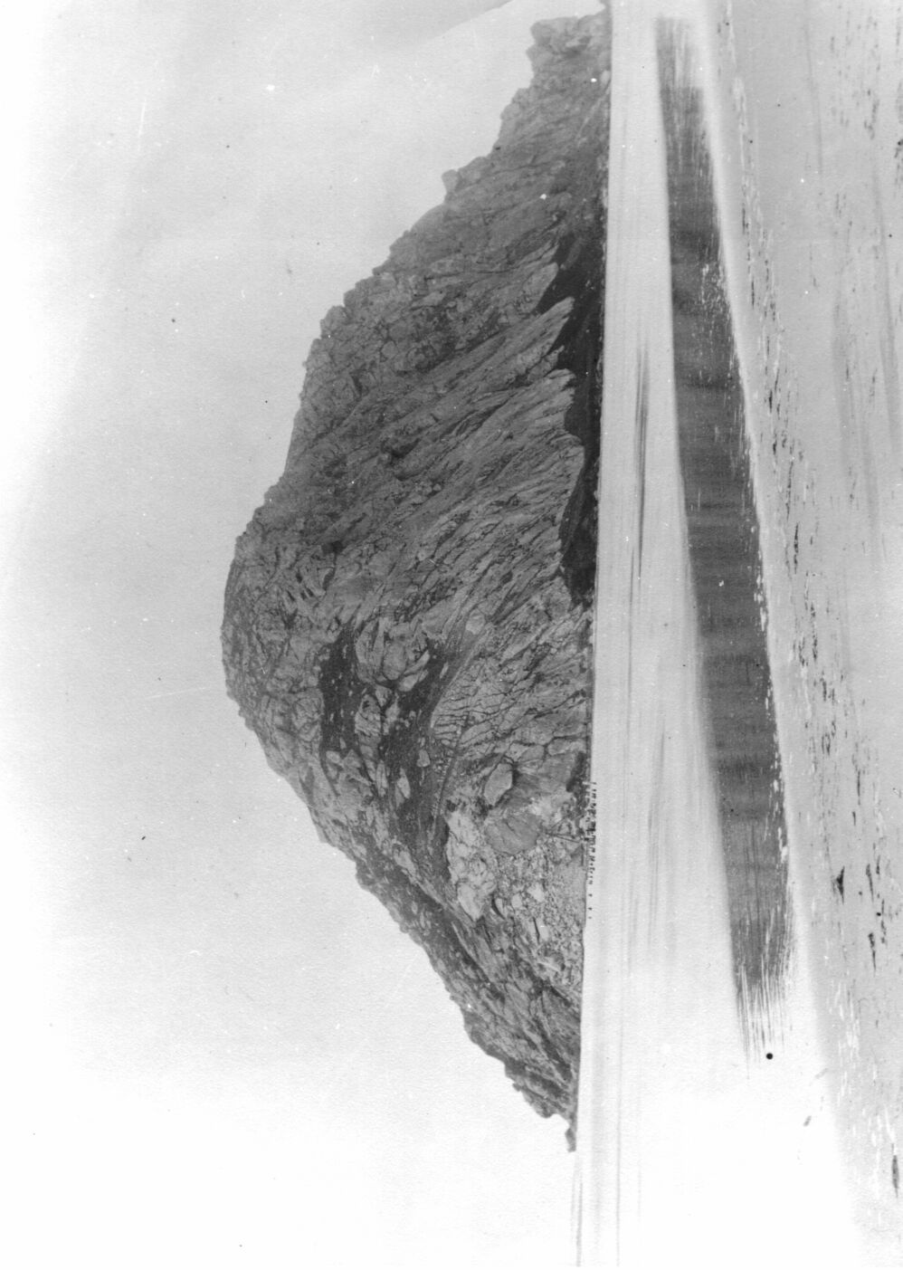
"Historical Morro Bay" #8, Source: Natural History Association
SLOC Docent Library (Note: This Morro
Rock #8 about 1900 link is a big 160K document to support full-page
high-resolution printing)
Note: Really big images like the above two links typically will not print completely from your browser (you are likely to get a corner printed out). To later print a big picture viewed in Internet Explorer or Netscape Navigator, you can right-button-click an image and save it to your hard disk. Then, If you need a good free utility to later print the above or other images, go to http://www.irfanview.com and download their IrfavView32 program, or use one of the many other free image processing programs available. |
|
04/2010 This link was removed at request of another site owner. |
|
|
|
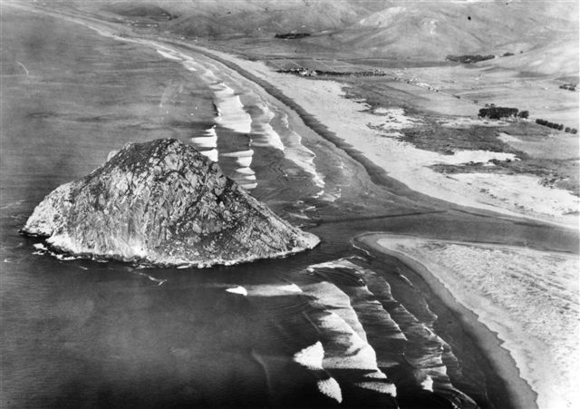
Pre-1933 aerial photo from north |
|
|
Pre-1933 aerial photo from east |
| 04/2010 This link was removed at request of another site owner. About 1935. This view looking from mainland near Duke Energy along where Coleman Drive is today, reveals the beginning of a connector being built from the island toward the mainland. (Courtesy of the Shell Shop). |
|
| 04/2010 This link was removed at request of another site owner. 1936 |
|
 |
1936 This photo was given to me by Red Truhitte 10-11-06, which he photographed from the wall of Kitty's Kitchen in Morro Bay |
| 04/2010 This link was removed at request of another site owner. 1938 |
|
| 04/2010 This link was removed at request of another site owner. Dec. 1941. |
|
| 04/2010 This link was removed at request of another site owner. 1943 |
|
| 04/2010 This link was removed at request of another site owner. 1944 |
|
| |
1950? Pre-Duke PG&E plant; Connection to the Rock is complete and wide |
| 1950's | |
| |
April, 1955. You can see the damage done to the breakwater due to high seas. Photo by Glen Bickford, from Morro Bay's Yesterdays, with permission. |
|
|
1956 A photo of PG&E's first exhaust stack, at night Courtesy Dave Dabritz |
| 1988 Source
is primary author: Nicholas M. Short, Sr. Source image from Portugal no longer displays |
|
| I2001 | |
| Here is a 360-degree QuickTime view of north of Morro Rock, near the power plant. |
More photos, yet to be integrated above
(the list below is repeated from the morro-bay.com
historical tab)
morro-bay.com
Docent Pages
morro-bay.com
Revised Monday, February 18, 2008 01:50:14 PM