Cerro Cabrillo, or Cabrillo Peak
Elevation 911 feet.
Named after Juan Cabrillo, it is located within the section of Morro Bay State Park bordered by Turri Road, South Bay Blvd., and Chorro Creek.
On June 1, 2001,
Docent Curt Beebe and Mike
Baird explored Cerro
Cabrillo to investigate the possible presence of a mountain lion.
The photos below document the event. (Click to
enlarge)
Docent Dr. Curt Beebe, and Mike Baird,
explored the west side of Cerro Cabrillo, up to the peak of Cabrillo west
(Cabrillo is made up of two peaks, called here "west" and
"east") and over to the peak of Cabrillo east, in search of evidence
of a mountain lion. Curt states that...
"A year ago [2000] I explored the west ridge of
Cerro Cabrillo on three occasions, in order to study the distribution of
poison-oak. On the third trip I discovered mountain lion tracks; scats;
and a partly eaten deer carcass. I had been looking for a companion
since, in order to safely visit the area again."
On this
exploration, he was better prepared to deal with a possible mountain lion
encounter, by having a hiking companion, and some special
"equipment."
Starting off in the "quarry trail" parking lot (map)
on South Bay Blvd., Curt donned a face mask to the back of his head ( a
technique reported to be successful for keeping a mountain lion from attacking
by surprise from behind), 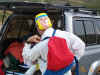 and packed his compressed-air horn in a ready pocket. Armed with heavy
clothing and foot "gators" we made our way through thick brush on
paths known previously only to unknown wild animals.
and packed his compressed-air horn in a ready pocket. Armed with heavy
clothing and foot "gators" we made our way through thick brush on
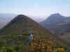
paths known previously only to unknown wild animals.  Heading up the west side of Cabrillo, views of the Estuary
 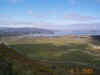 and Black Hill
 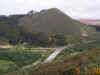 were seen. Curt is framed here by Sticky Monkey Flowers
 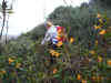 ,
just one of many beautiful flowers and ferns
,
just one of many beautiful flowers and ferns 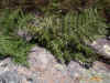 encountered. Crawling through very dense brush, and under low Oak trees
(where we hoped to find a lair) [no photos were taken of these due to the difficulty
in "walking" and photographing at the same time] we emerged near the
peak
encountered. Crawling through very dense brush, and under low Oak trees
(where we hoped to find a lair) [no photos were taken of these due to the difficulty
in "walking" and photographing at the same time] we emerged near the
peak 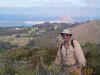 of the west side of Cerro Cabrillo. Heading east, we encountered a very
large birds nest (or at least we thought it was a bird's nest)
of the west side of Cerro Cabrillo. Heading east, we encountered a very
large birds nest (or at least we thought it was a bird's nest)  several feet across, with an almost foot-wide hole in the center.
 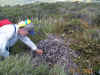 Here is a close up of the nest,
 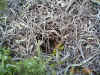 and here is a detailed shot showing the "weave" structure
(approximately 8 inch field-of-view here)
and here is a detailed shot showing the "weave" structure
(approximately 8 inch field-of-view here) 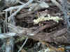 .
If anyone knows what animal made this, please e-mail
us. Proceeding east, we saw Cabrillo east, and Hollister
Peak in the distance
.
If anyone knows what animal made this, please e-mail
us. Proceeding east, we saw Cabrillo east, and Hollister
Peak in the distance 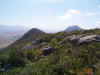
 .
To our left (north), the Chorro
Flats Floodplain was visible
.
To our left (north), the Chorro
Flats Floodplain was visible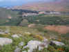 .
Arriving at the very peak of Cerro Cabrillo, Curt relaxes
.
Arriving at the very peak of Cerro Cabrillo, Curt relaxes 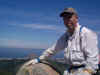 and enjoys the views at the 911 feet elevation
  , before the return via the traditional
east trail, past
, before the return via the traditional
east trail, past 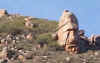 Tike Rock, and through many small brown, and black, lizards, including this
black species
Tike Rock, and through many small brown, and black, lizards, including this
black species 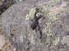 ,
the presence of which seemed to be more common above 700 feet.
,
the presence of which seemed to be more common above 700 feet.
 and packed his compressed-air horn in a ready pocket. Armed with heavy
clothing and foot "gators" we made our way through thick brush on
paths known previously only to unknown wild animals.
and packed his compressed-air horn in a ready pocket. Armed with heavy
clothing and foot "gators" we made our way through thick brush on
paths known previously only to unknown wild animals.  Heading up the west side of Cabrillo, views of the Estuary
 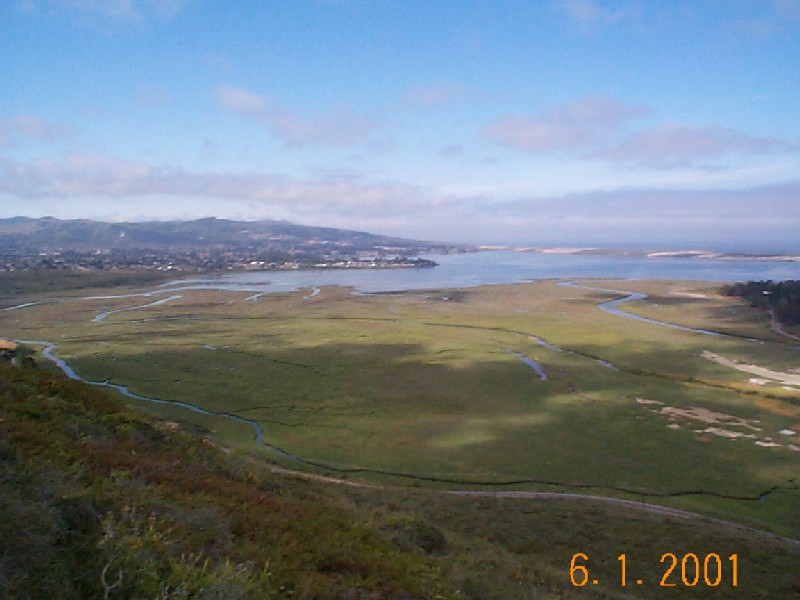 and Black Hill
 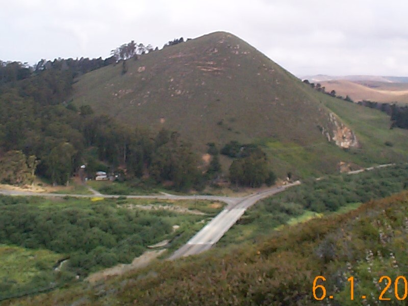 were seen. Curt is framed here by Sticky Monkey Flowers
 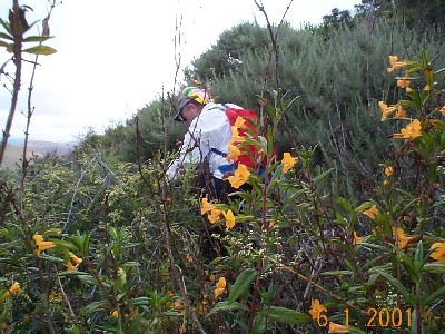 ,
just one of many beautiful flowers and ferns
,
just one of many beautiful flowers and ferns 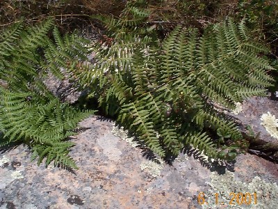 encountered. Crawling through very dense brush, and under low Oak trees
(where we hoped to find a lair) [no photos were taken of these due to the difficulty
in "walking" and photographing at the same time] we emerged near the
peak
encountered. Crawling through very dense brush, and under low Oak trees
(where we hoped to find a lair) [no photos were taken of these due to the difficulty
in "walking" and photographing at the same time] we emerged near the
peak  of the west side of Cerro Cabrillo. Heading east, we encountered a very
large birds nest (or at least we thought it was a bird's nest)
of the west side of Cerro Cabrillo. Heading east, we encountered a very
large birds nest (or at least we thought it was a bird's nest) 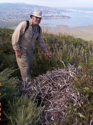 several feet across, with an almost foot-wide hole in the center.
 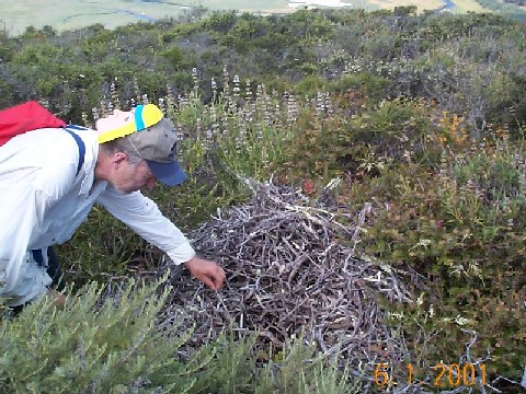 Here is a close up of the nest,
 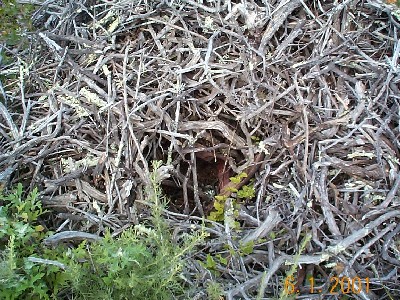 and here is a detailed shot showing the "weave" structure
(approximately 8 inch field-of-view here)
and here is a detailed shot showing the "weave" structure
(approximately 8 inch field-of-view here)  .
If anyone knows what animal made this, please e-mail
us. Proceeding east, we saw Cabrillo east, and Hollister
Peak in the distance
.
If anyone knows what animal made this, please e-mail
us. Proceeding east, we saw Cabrillo east, and Hollister
Peak in the distance 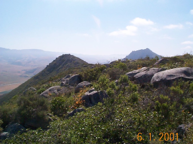
 .
To our left (north), the Chorro
Flats Floodplain was visible
.
To our left (north), the Chorro
Flats Floodplain was visible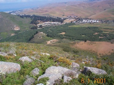 .
Arriving at the very peak of Cerro Cabrillo, Curt relaxes
.
Arriving at the very peak of Cerro Cabrillo, Curt relaxes  and enjoys the views at the 911 feet elevation
 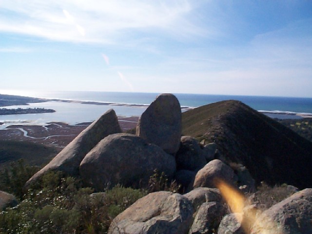 , before the return via the traditional
east trail, past
, before the return via the traditional
east trail, past  Tike Rock, and through many small brown, and black, lizards, including this
black species
Tike Rock, and through many small brown, and black, lizards, including this
black species  ,
the presence of which seemed to be more common above 700 feet.
,
the presence of which seemed to be more common above 700 feet.